

Cool temperatures and occasional rain showers slowed the growth of the Haystack Fire south of Boulder on Sunday and early this week after the fire exploded to more than 10,000 acres on Saturday, but dangerous fire conditions forecast for later this week and this weekend could accelerate the fire’s growth.
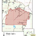
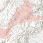
The Haystack Fire was estimated to be 10,300 acres on Tuesday morning with only 8% containment, after low humidity, warm temperatures and high winds—particularly on Saturday, when gusts hit around 60 mph—caused the fire to expand by orders of magnitude and reach the North Fork of the Little Boulder River to the north and the upper reaches of West Creek and Beaver Creek to the east, little more than a mile west of Whitetail Road.
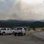
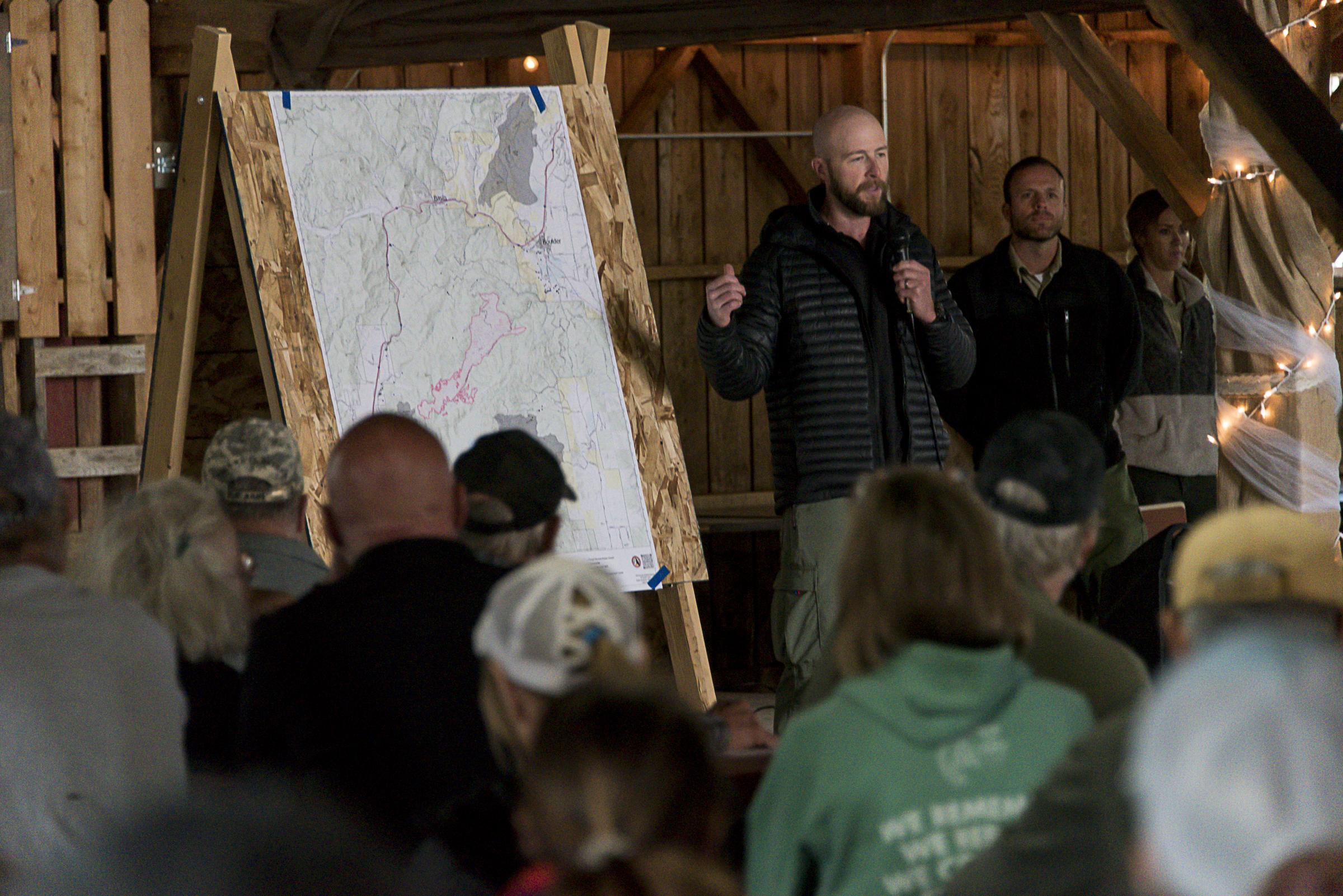
“We’ve got a couple days of reprieve right now, but later in the week it’s looking like more fire weather, so we’re still in the thick of it now,” Cory Kirsch, the co-incident commander and chief of Boulder-Bull Mountain Rural Volunteer Fire Department, said at a community information meeting on Sunday afternoon. Kirsch is also a Jefferson County commissioner.
A pre-evacuation notice remains in effect south of Boulder for residents south of the Boulder River and Cattle Drive Lane, west of state Highway 69 and north of, and including, the Boulder Hot Springs. A pre-evacuation notice west of Boulder for “the Depot Hill Road area north of I-15 including the Silver Bell Road area and Boomerang Gulch” was issued midday Saturday when shifting winds caused concern that the fire could jump Interstate 15 and burn on Depot Hill. That notice was cancelled on Sunday. No evacuation orders have been issued.
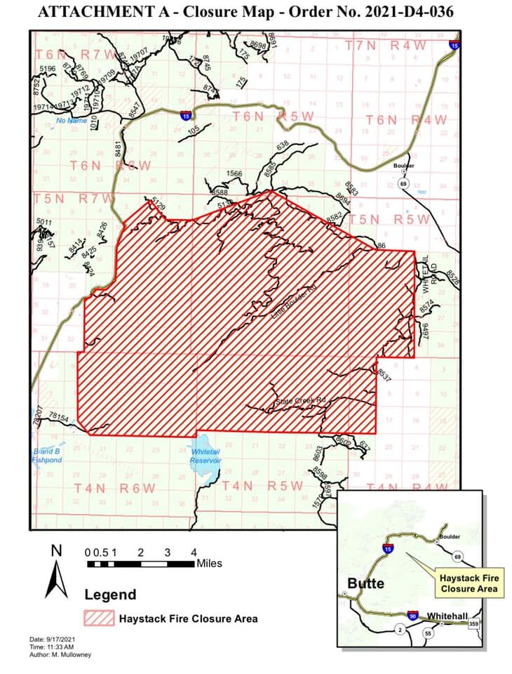
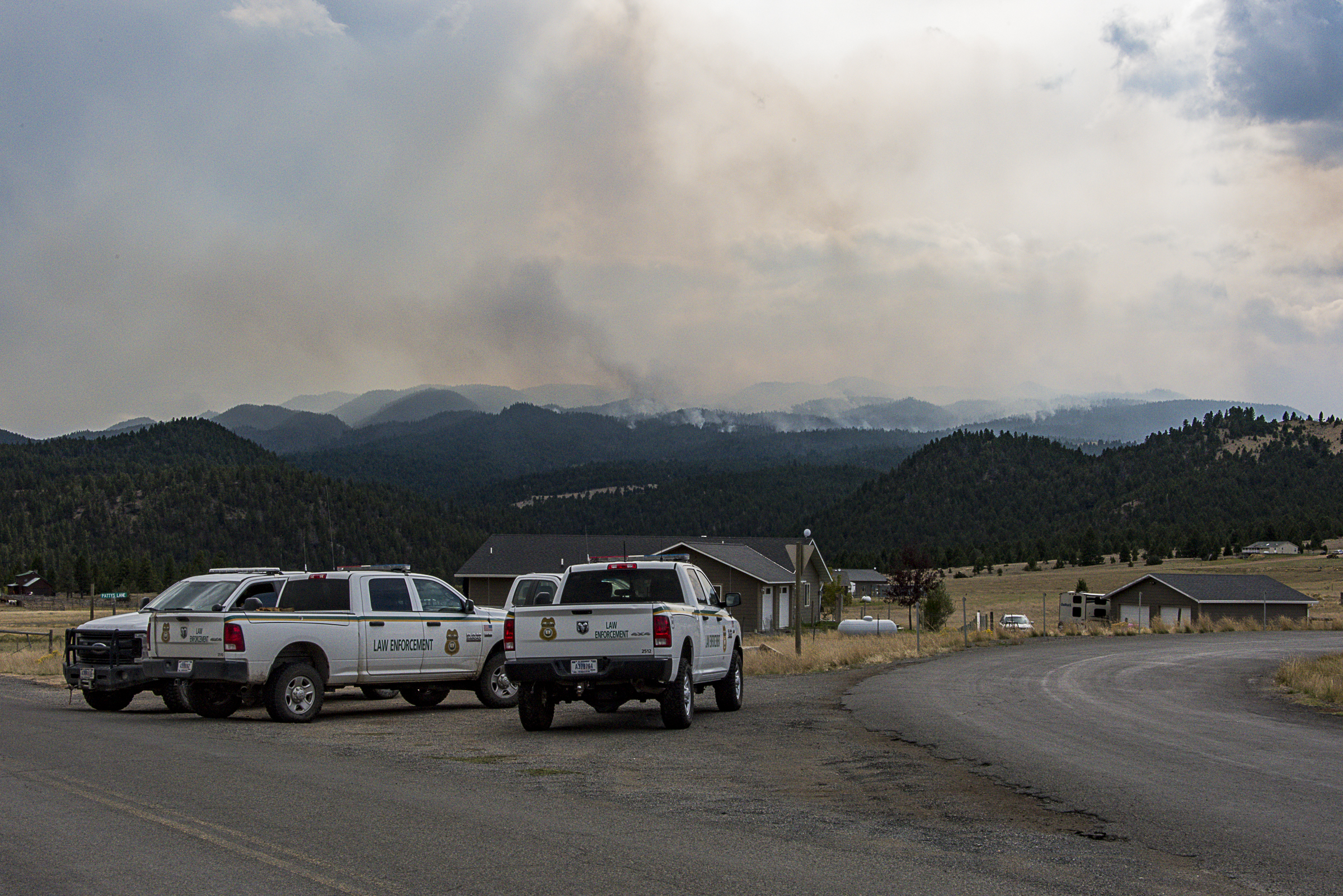
The U.S. Forest Service on Friday issued an area closure spanning from I-15 on the west to Whitetail Road on the east, and from Whitetail Reservoir on the south to the top of Galena Gulch on the north, and including the North Fork Road on the north side of the closure. Only authorized personnel can enter the closure area.
The Forest Service on Sunday established a Facebook page specifically for information about the Haystack Fire, accessible at https://www.facebook.com/Haystack-Fire-264884752030412/.
Speaking to a large audience at the Jefferson County fairground’s White Barn on Sunday, incident commanders and Beaverhead-Deerlodge National Forest officials said that firefighters set up sprinklers and water supplies around cabins along Little Boulder Road, which they said survived the fire so far, and around the most threatened homes in the pre-evacuation notice area.
A pre-evacuation notice, Kirsch stressed, is not an evacuation order. The notice, he said, means residents should “be ready to get out” if an evacuation is ordered, and the notice “just gives you a little time to think about that,” because an actual evacuation order could come with as little as a couple hours’ notice. The Jefferson County Sheriff’s Office has the sole authority to order an evacuation, forest leaders said, as some meeting attendees shared photos of evacuation orders—not pre-evacuation notices—they received on Saturday, leading to confusion over who should evacuate and when. Kirsch reiterated that no evacuations had been ordered.
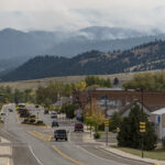
Though officials have crafted contingency plans for it as a precaution, “we haven’t even fathomed having to evacuate Boulder,” Kirsch said about the possibility of evacuating residents within city limits.
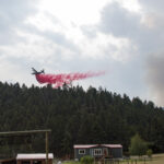
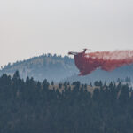
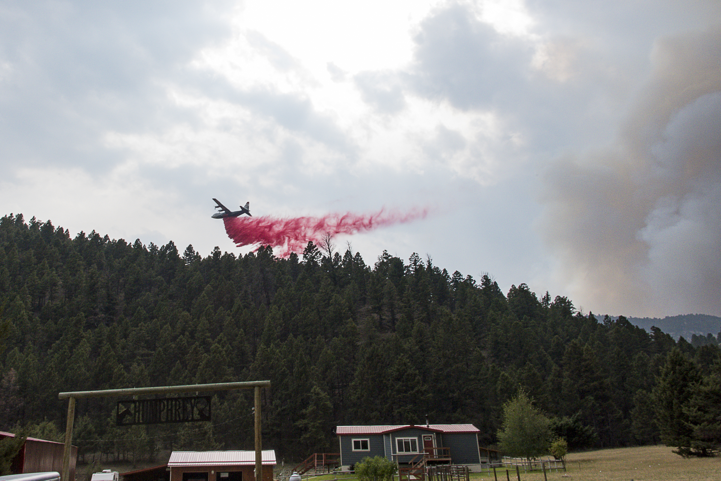
On Saturday, Co-Incident Commander Shane Martin said, three tanker planes dropped fire retardant in a line from just south of I-15, behind homes along Cattle Drive Lane, going southeast behind homes off of Little Boulder Road.
Martin, who is the assistant fire management officer for the Butte Ranger District of the Beaverhead-Deerlodge National Forest, said he hoped crews could stop the north side of the fire at the North Fork Road, which the fire has reached in some places, and that crews were using bulldozers to establish a “backup contingency line” along the crest of Doe Ridge south of Boulder.
On the east side of the fire, “when the conditions are right and in our favor, we’ll look at potentially doing some burning on our lines … so we can try and stop it on the west side of the Whitetail Road,” Martin said, adding that the southwest front of the fire, near Elk Park and the fire’s ignition point on Haystack Peak, is being monitored by one engine with personnel in Elk Park, and that “we don’t have much [fire activity] going on there.”
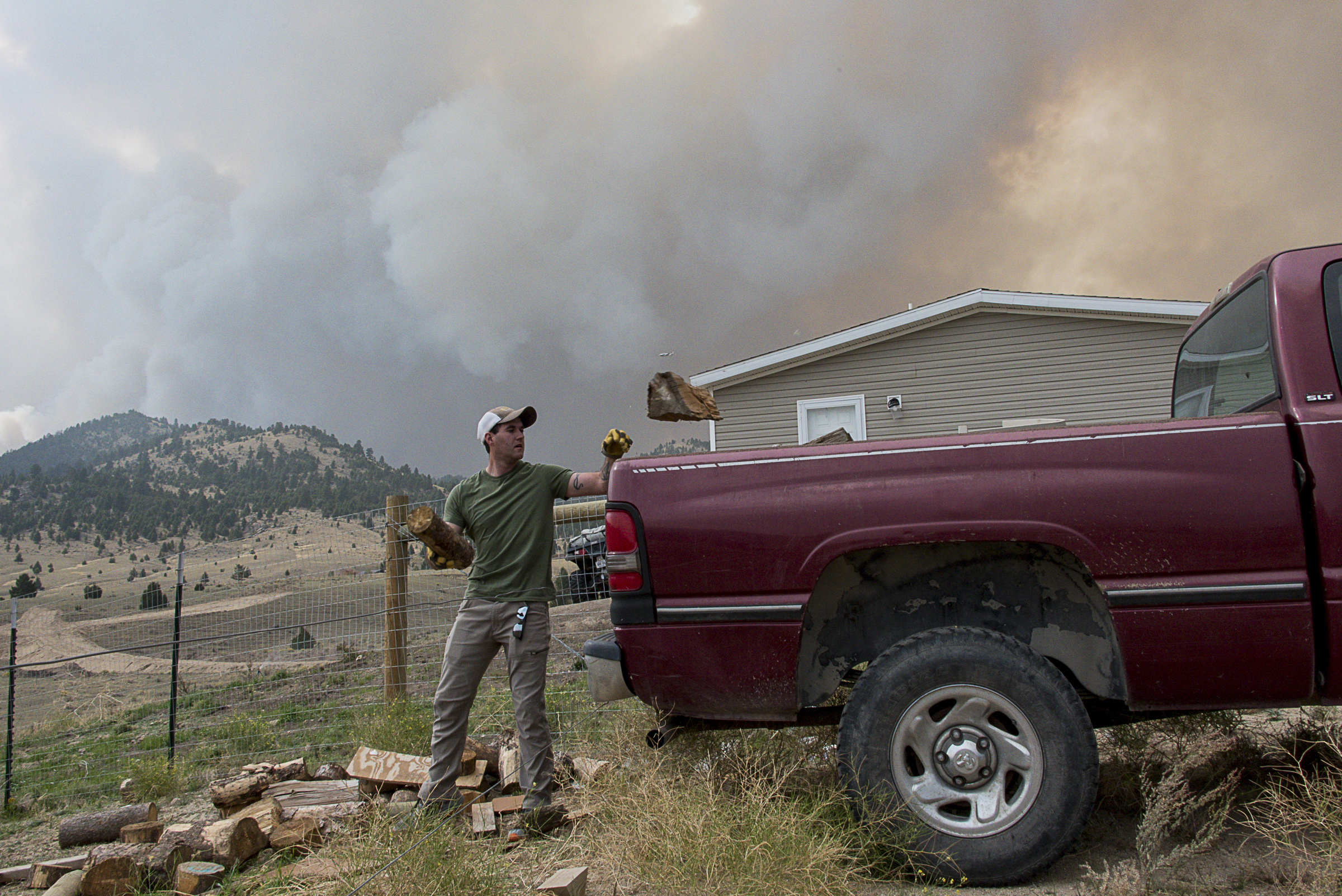
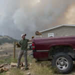
Along Patty’s Lane, off of Little Boulder Road and in the current pre-evacuation area, Matthew and Colleen Wilson were preparing on Saturday afternoon to evacuate their home if ordered.
“We were ready for it. We knew what we needed to grab,” Matthew Wilson, 33, said, as he worked to clear brush and other flammable material from around the house, which he said he and Colleen built about a year ago.
Matthew Wilson said that he wasn’t sure where he, Colleen, their 4-year-old son, four dogs, a cat and fish would go if ordered to evacuate, but that he had some places around Boulder in mind.
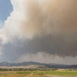
As they packed a camper trailer hitched to a pickup in front of the house, the plume of smoke loomed overhead, dotted by air tankers circling the sky.
“How do you decide what to bring and what to leave?” Colleen Wilson, 35, said, recalling that she evacuated from the same area as a child in 2000.
She said that her sister and parents live on adjoining properties and were trying to figure out how to evacuate, among other things, as many as eight horses. With the help of friends and neighbors, she said, she believed they had it figured out.
“I like that even though the world’s so ugly right now, with something like this, everybody pitches in,” she said.
Anyone who needs assistance evacuating or relocating can call the American Red Cross at 1 (800) 272-6668.
The Forest Service became aware of the fire on July 31, while fighting the Gatlin Gulch Fire that ignited on July 30, and forest officials believe that both fires were ignited by lightning on the same day. The fire smoldered for weeks at around a few acres before intermittently growing throughout late August, experiencing occasional flare-ups but remaining smaller than 500 acres until about two weeks ago. By late afternoon Sept. 8, the head of the fire was in the upper reaches of the Buffalo Creek drainage off of the Little Boulder River, according to Martin.
The fire’s slow growth early on, officials said, was due to the terrain in the area being mostly rock and large boulders with occasional vegetation, rather than a densely timbered forest where the fire could explode. It is now burning in more fuel-laden terrain.
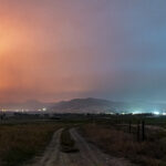
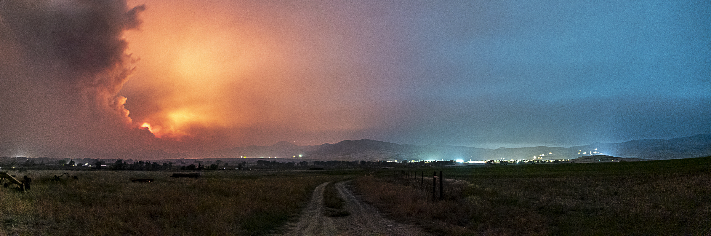
By last week, Martin said, the fire made it to Moose Creek and was about 2,500 acres going into the weekend. On Friday evening, smoke filled the valley floor, clogging the air in and around town and turning the setting sun into a dim, orange dot.
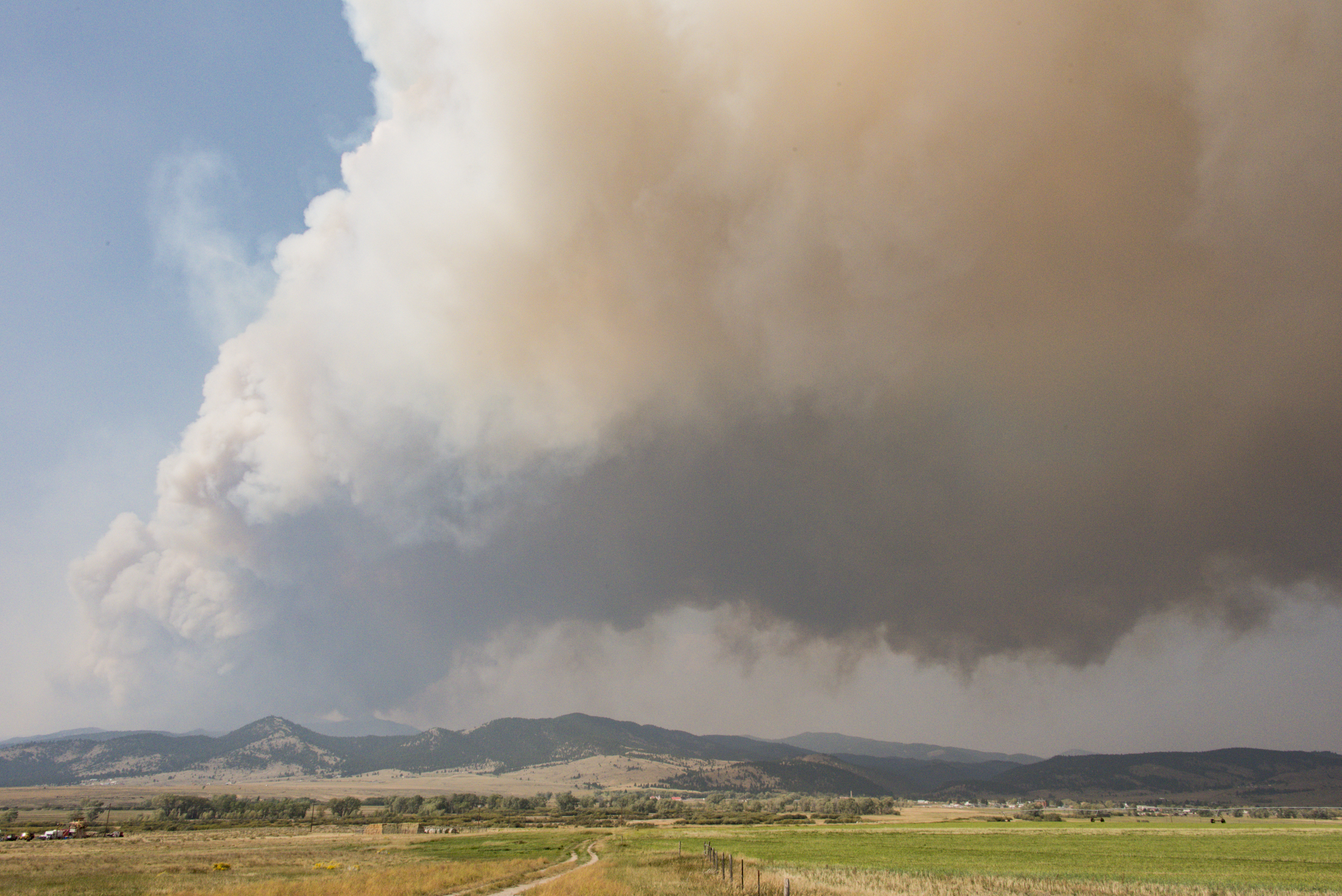
Then, on Saturday, came what “the [National] Weather Service called … an every 5–10-year wind event,” he said, which caused the fire to explode to more than 10,000 acres and sent a billowing column of smoke into the sky south of Boulder.
“It was just kind of prime conditions for a fire to move,” Martin said, explaining that the fire’s rapid growth led incident commanders to order personnel to fall back to Boulder and surrounding private lands to the south and west of town.
“The only thing you can really do is get people and things out of the way,” District Ranger Tim Lahey said.
Strong, shifting winds throughout Saturday afternoon at times blew the smoke plume directly over Boulder and, at other times, west of Boulder over Depot Hill. Just after sunset, winds from the west were blowing the smoke to the east of the fire, south of Boulder.
The area received rain on Sunday, but it “was much less than we were hoping for or expecting to receive,” Martin said. Daytime high temperatures Sunday and Monday were just over 50 degrees.
And, with the return of warm temperatures, low humidity and high winds later this week and into the weekend, he said, “we’re going to have some critical fire days coming up to this weekend.”

